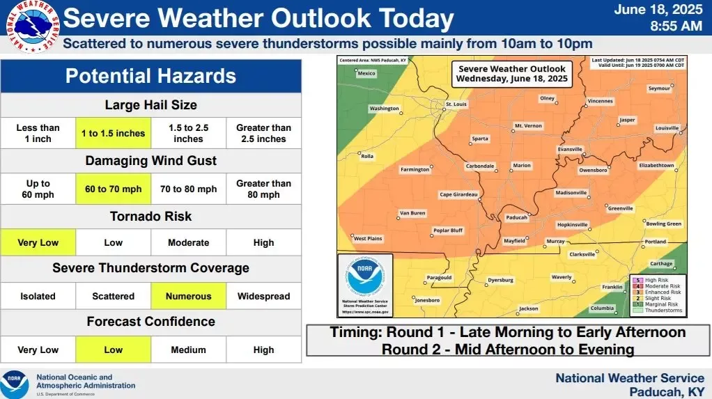
A bulk of the region has been upgraded to an enhanced risk for severe storms, or a level 3/5 threat, for Wednesday afternoon and evening.
Forecasters from the National Weather Service in Paducah said that severe weather may start earlier than anticipated as a line of storms pushes from southeast Missouri into the Evansville Tri-State area, including portions of western Kentucky near the Ohio River.
They added that this system will leave a trailing line of strong to severe storms across western Kentucky from mid-afternoon to evening hours.
The threats of hail up to 1.5″, damaging wind gusts ranging from 60-70 MPH, and a very low tornado risk remain possible. Your Weather Edge will be monitoring the system and will provide breaking weather coverage on this Edge Media Group radio station and web stream.