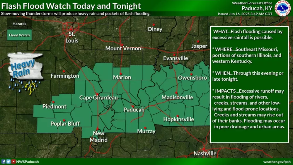
A Flood Watch is in effect from late this morning through late tonight.
The National Weather Service says slow-moving thunderstorms will produce torrential downpours and the risk of flash flooding. Thunderstorms that develop today will also produce very high levels of lightning. Excessive runoff can lead to flooding in rivers, creeks, streams, and other low-lying, flood-prone areas. Creeks and streams may rise out of their banks. Flooding may occur in poor drainage and urban areas.
Meanwhile, the National Weather Service says severe thunderstorms are possible on Wednesday, mainly during the late afternoon and evening hours. Damaging winds, a few tornadoes, and large hail will be the main severe risk. Heavy rain and isolated flooding issues are possible as well.
Heat index values of 100 to 105 degrees are forecast this weekend.