Significant flooding is ongoing across the region, while electric crews are working to restore power.
A continuous stream of Flash Flood Warnings was issued Friday morning for Trigg, Christian, Todd, and southern Muhlenberg counties. The latest of which remains in effect until 12:15 PM Friday.
As of 4:30 AM, the Trigg County Kentucky Mesonet site, four miles southwest of Cadiz, had recorded 2.63 inches of rain since midnight. The three-day rain total had blown past 7 inches.
In Christian County, at the site six miles north of Hopkinsville, 2.72 inches have been recorded since midnight. The three-day rain total is just shy of 8 inches.
Todd County’s three-day rain total was 4.92 inches, with Caldwell County around 5.75 inches.
Flooded roadways have become a common sight throughout the region. In Trigg County, the northern end of Glenwood Mill Road has flooded over the roadway, near Little River Vet Clinic. Meanwhile, standing water in Cadiz behind King’s Auto Sales on East Noel Drive has risen significantly and is on the verge of overtaking the nearby alternate route.
During the overnight hours, the Kentucky Transportation Cabinet reported significant high water on Kentucky 911 between mile markers 0 and 2, and Kentucky 400 between mile points 0 and 1.3. Additionally, in Caldwell County, high water was observed on Kentucky 139 at the 4.5-mile point in the southern part of the county, as well as at the intersection of Kentucky 191 and Kentucky 1280 – Cadiz Street.
As of 4:45 AM, Pennyrile Electric crews were addressing over 65 separate outages across their service area. Spokesman Brent Gilkey reported that several broken poles were discovered in Trigg and Christian Counties. One of the most affected areas is on Canton Pike, between Food Lion and the U.S. 68-Bypass/Eagle Way, where the road remains closed until repairs can be completed.
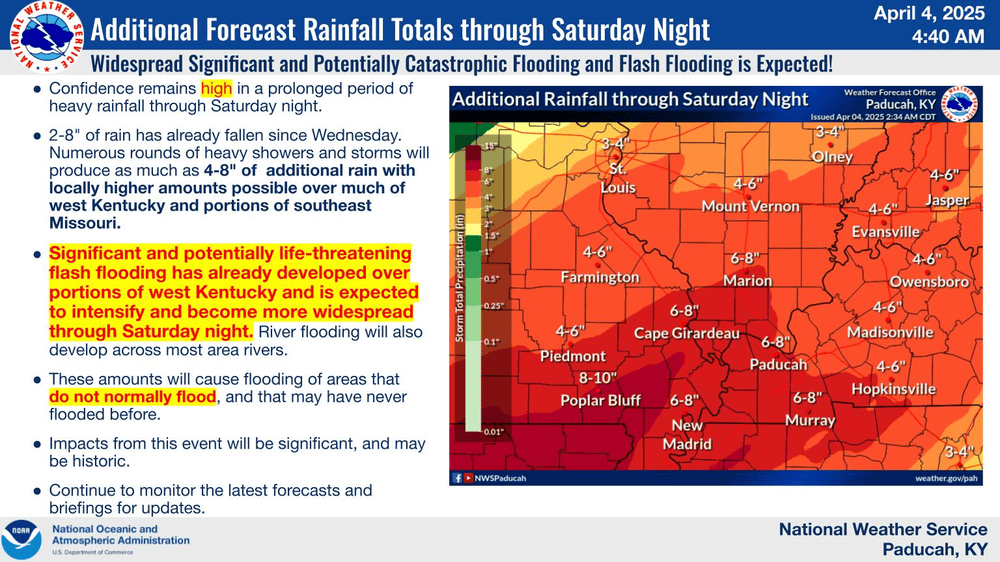
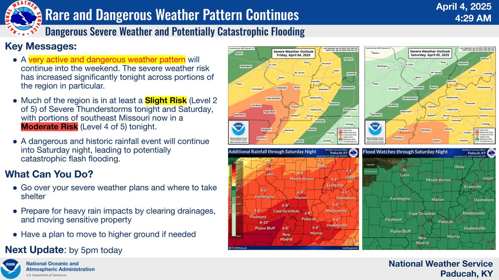
An additional 4-8″ is still expected across the region through Saturday night. The Storm Prediction Center has issued slight risks for severe weather Friday and Saturday.
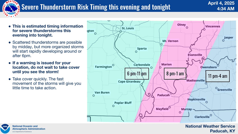
Friday’s severe weather threat will feature large hail, damaging winds, and tornadoes. The National Weather Service in Paducah says scattered thunderstorms are possible by midday, but more organized storms will start rapidly developing around 6:00 Friday evening in southeast Missouri and southern Illinois. The threat should fully be out of the region around 4:00 AM on Saturday.
As has been the case with this entire system, Your Weather Edge team is standing by and ready to provide the latest weather information on-air and via our web streams.