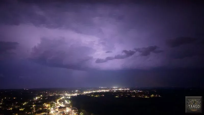
Wednesday night’s bout with severe weather in south western Kentucky truly first began when, around 6:55 PM, Christian and Todd counties got their first tornado warnings — following tracked storms from northwestern Tennessee.
That storm produced pea- to quarter-sized hail in Oak Grove and Pembroke, before shifting eastward.
A second round of storms, however, were much more severe for the Pennyrile and Jackson Purchase, and they began moving through the News Edge listening area around 8:45 PM.
In the north, along the Ohio River, Ballard, Carlisle, McCracken and Livingston counties sustained notable damages and larger power outages. As of midnight, four injuries had been reported in Ballard County along with spots of alleged “catastrophic” damage, while west Paducah — and particularly Christ Community Church along Old Hinkleville Road — bore the brunt of strong winds and a possible tornado. In and around Smithland, Livingston County recorded at least 1,800 power outages.
In the south, weather spotters detected an on-the-ground tornado, unofficially “large,” two miles southwest of Murray. While there have been numerous reports of building damage in southern Graves and Calloway counties, damage seemed to well-mitigated within city limits.
This “lead line” of severe weather also moved through Marshall County, producing a reported tornado that eventually had rotation in Lyon and Caldwell counties, and later, a weather spotter indicated an on-the-ground tornado two miles north of Madisonville — one that crossed I-69 near Hanson before moving into Muhlenberg and McLean counties.
Several power lines and trees have been marked as “down” near the Nebo area of Hopkins County.
Dozens of tornado warnings were observed in west Kentucky and northwest Tennessee counties during the sweeping wave, including Calloway, Trigg, Christian, Todd, Caldwell, Hopkins, Crittenden, Lyon, Marshall and Stewart.
In fact, rotation was observed coming out of Calloway and into Trigg just south of Canton, and that system moved to the west of Cadiz, through Cerulean and into Christian County.
Early reports from emergency management indicated that there is tree and roof damage to some buildings in Trigg and Christian counties.
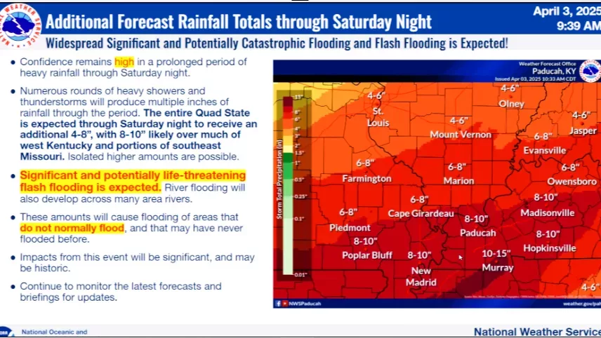
Multiple rounds of showers and thunderstorms, with heavy rainfall and mixed chances of severity, are expected Thursday through Saturday night. A Flood Watch remains in effect now until Sunday morning, April 6, and significant flash flooding cannot be ruled out — as rapid rises on area rivers feels “likely.” River flooding has already been cast in some west Kentucky locations, and the worst Flash Flooding threat, according to the National Weather Service, will be Friday through Saturday night.
These storms Wednesday produced no less than two inches of rain for the entire News Edge listening area, and another 6-to-8 inches is expected through Friday night.
A bevy of emergency shelters were pre-emptively opened in Trigg, Christian, Todd and Caldwell counties…and as of midnight, no injuries had yet been reported in those counties.
Before storms arrived Wednesday, just before that 6 PM hour, temperatures reached the mid-80s in most of western Kentucky.
By midnight, south western Kentucky showed 66 degrees in Madisonville, 70 degrees in Hopkinsville, 70 degrees in Elkton and 70 degrees in Cadiz.
As for the national outlook of Wednesday, the National Weather Service had the News Edge listening area within its rare 5-out-of-5 “High Risk” rating, while the Weather Channel had an area marked from Little Rock, Arkansas, to northeast past Paducah, Henderson and Evansville, Indiana, under a TorCon 9-out-of-10.
At 6:30 PM, more than 25 tornado warnings were active along the main front spanning more than 300 miles, with damage reported in Oklahoma and Arkansas behind it.
Unofficial at this point, but one of the largest tornadoes in the system spawned and roared near Lake City, Arkansas, just two hours southeast from Fulton County.
At 12:22 AM Thursday, officials from the National Weather Service office in Paducah gave the clear, with the exception of ongoing flash flooding across the region.
Multiple damage surveys are expected to take place beginning Thursday, and the days following.


