The National Weather Service says 2024 was a very active year, particularly the spring and summer. The region began the year experiencing one of the warmest winters on record with very little snow which meant most areas only received 1/2 to 3 inches.
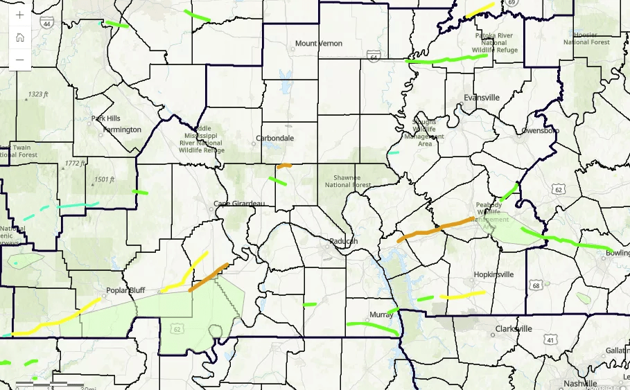
Forecasters say there were a total of 59 tornadoes that touched down across the area in 2024, which was the 2nd most on record for a year only behind the 79 in 2011. The tornadoes covered a total of 443.2 miles (also 2nd most behind the 449.8 miles in 2011). There were 4 EF-3’s, one of which became our strongest July tornado on record. The vast majority of them (53) occurred during 4 events: April 2, May 8, May 26, and July 9.
Summer-like temperatures were observed in February, with readings soaring to 90 degrees in Van Buren, MO on the 27th! Cape Girardeau and Carbondale tied their February warmest temperature of 79 degrees. There were three especially notable severe weather events during the spring. The April 2nd early morning tornado outbreak included 19 tornadoes, the most tornadoes in a single day for the Quad State region since Halloween 2013. The May 8th multi-round severe weather outbreak included 9 tornadoes and set the office record for most tornado, severe thunderstorm, and tornado warnings issued in a single day. The May 26th multi-round severe weather outbreak included widespread straight-line wind damage along with 18 tornadoes, and the second highest single day warning issuance count.
Remnants of 3 tropical systems impacted the region during the summer and fall seasons. The first of these produced a rare July tornado outbreak on the 9th when the remnants of Beryl produced 7 tornadoes including an EF-3 that struck Mount Vernon, IN. This was the strongest tornado on record in the area in the month of July. Two other tropical systems impacted the region in September, Francine and Helene. The 2nd of these resulted in rather significant rainfall totals across the region with many areas observing 3 to 6″ in a 72 hour period ending on September 29th. Fortunately, it was beneficial rain that helped ease the developing moderate to severe drought conditions and produced limited flooding due to its prolonged nature. Paducah observed the lowest barometric pressure on record for September on the 27th. Paducah also received 5.33″ of rain that day, which was the second wettest September day on record for the city.
The faucet shut-off after Helene departed, with the region experiencing one of our driest first 30 days of October on record. The period from October 1-30 was the 2nd driest on record in Paducah with only 0.07″, while Evansville clocked in as their 3rd driest with only 0.02″ during that period. Rain finally returned to the region on Halloween with a wetter pattern continuing into the first half of November. Temperatures remained quite mild, with November finishing closer to what a typical October would feel like. This helped boost us to one of our warmest Fall seasons (2nd warmest in Paducah). The year 2024 finished as the warmest on record in Paducah and Cape Girardeau and 2nd warmest in Evansville. The only months which finished below normal were January and July.


